25 Apr 2026
- 0 Comments
Key Takeaways for Clear Skies
- Cloud cover is rarely uniform; "broken" skies often mean usable gaps.
- High-resolution models like the HRRR provide a more accurate window than general apps.
- Satellite imagery helps you "chase" the gaps in real-time.
- Combining dew point and temperature data prevents unexpected fog.
Decoding the Cloud Cover Lie
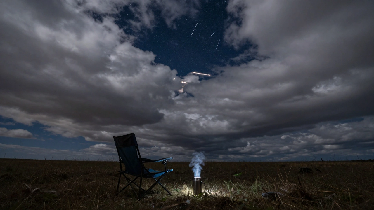
When you check a standard phone app and see "80% cloud cover," most people pack up. But that percentage is often a measurement of the total sky area, not the quality of the view. For a meteor shower is an astronomical event where Earth passes through a trail of comet debris, creating streaks of light in the atmosphere, you don't need a perfect blue dome. You just need a gap in the clouds that aligns with the radiant point of the shower.
The real danger isn't just clouds, but the type of clouds. Cirrus clouds-those thin, wispy strands-might technically count as coverage, but they are practically transparent. Conversely, a low-hanging stratus layer is a wall. If your forecast shows high-altitude clouds, keep your gear ready. If it shows low-level moisture, that's when you start looking for a different location.
The Professional Forecast Toolkit
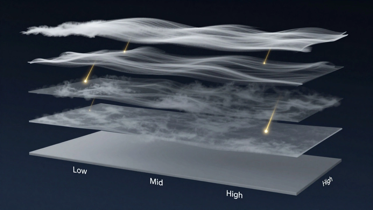
To actually salvage a night, you need to move past basic weather apps. You need tools that visualize the atmosphere in layers. Clear Outside is a specialized weather application designed for astronomers that breaks down cloud cover by altitude. By looking at the "Low," "Mid," and "High" cloud layers, you can tell if you're dealing with a temporary passing haze or a systemic storm front.
For those who want a deeper dive, the HRRR Model (High-Resolution Rapid Refresh) is the gold standard. It's a numerical weather prediction system that updates every hour. Unlike a 7-day forecast, which is a guess, the HRRR tells you what is happening right now and where the moisture is moving. If you see a narrow strip of low precipitation moving toward you, that's your window.
| Tool | Best Use Case | Accuracy Level | Key Feature |
|---|---|---|---|
| Standard Phone Apps | General planning | Low (Averaged) | Convenience |
| Clear Outside | Layer analysis | High | Altitude breakdown |
| HRRR Model | Last-minute windows | Very High | Hourly updates |
| Satellite Imagery | Real-time chasing | Absolute | Visual cloud movement |
Using Satellite Imagery to Chase the Gaps
If the forecast looks grim, stop looking at the numbers and start looking at the pictures. GOES-East and GOES-West are geostationary satellites that provide real-time imagery of the Americas. By watching the infrared loop, you can see the "texture" of the clouds.
Look for "cellular" patterns. When clouds look like popcorn, there are usually gaps between the cells. If the clouds look like a smooth, flat sheet, you're out of luck. If you see a clear slot moving at 20 mph, and you're only 30 miles from that slot, a quick drive could be the difference between seeing zero meteors and seeing a hundred. This is the same technique used by storm chasers, just in reverse-you're chasing the void.
The Fog Trap: Dew Point and Temperature
Sometimes the sky is perfectly clear, but you still can't see anything. This is the "invisible cloud"-fog. To avoid this, you need to track the Dew Point, which is the temperature to which air must be cooled to become saturated with water vapor.
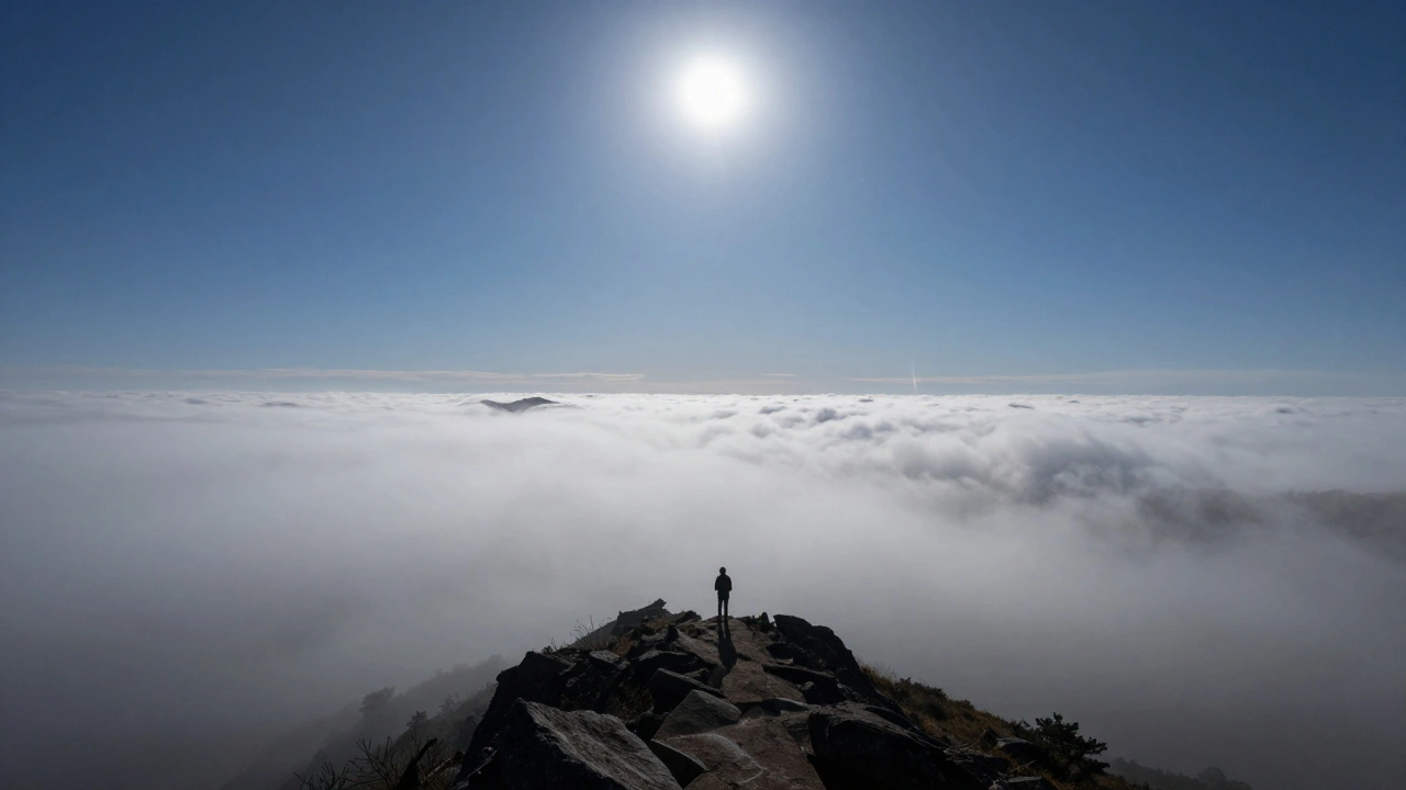
If the air temperature drops and hits the dew point, water condenses into fog. If you're in a valley or near a lake, this happens fast. A pro tip: check the dew point of your target location. If the temperature is only 1 or 2 degrees above the dew point, the risk of ground fog is high, even if the satellite shows clear skies. In these cases, driving to a higher elevation-even just a few hundred feet up a hill-can put you above the fog line and back into the clear.
Strategizing Your Viewing Window
Timing is everything. Most meteor showers, like the Geminids, have a peak window that lasts several hours. Don't give up if it's cloudy at 9 PM. Atmospheric pressure changes can clear the sky rapidly by midnight. Use a "windowing" strategy: check your forecast tools every 30 minutes. If the cloud deck is breaking or shifting, move your gear immediately.
Also, consider your radiant point. For the Leonids, the radiant is in Leo. You don't need the whole sky to be clear; you just need a gap in the direction of the radiant and the surrounding area. If the horizon is cloudy but the zenith (the point directly above you) is clear, you'll still catch the most dramatic long-trail meteors.
Common Pitfalls to Avoid
One of the biggest mistakes is trusting a "Clear" forecast without checking for humidity. High humidity doesn't always mean clouds, but it creates a "haze" that kills the contrast of fainter meteors. Another error is ignoring the moon. A full moon can wash out a meteor shower just as effectively as a cloud layer. Use a moon phase calendar to plan your night, and if the moon is bright, find a spot where a building or hill blocks the moon while leaving the rest of the sky open.
Can I see meteors through thin clouds?
Yes, but only the brightest ones. High-altitude cirrus clouds are often thin enough to let light through, though they will reduce the total number of meteors you see. If you see "milky" stars, you're likely dealing with thin clouds; keep watching, as these often break apart quickly.
Which is better: a weather app or a satellite map?
For long-term planning, apps are fine. For the actual night of the event, satellite maps are far superior because they show real-time movement. An app tells you the probability of clouds; a satellite shows you exactly where the clouds are and where they are going.
What does "broken clouds" mean for stargazing?
"Broken" usually means 5/8 to 7/8 of the sky is covered. While it sounds bad, it means there are actual holes. In these conditions, you can often find a gap that stays open for 15-30 minutes, which is plenty of time to see a burst of meteor activity.
How does the dew point affect my view?
When the air temperature drops to the dew point, moisture condenses. This creates fog or heavy dew on your equipment. If the gap between current temp and dew point is small, you might experience "ground haze," which obscures the horizon and makes the sky look murky.
Is the HRRR model available to the public?
Yes, through various weather portals and specialized aviation weather sites. It's more complex to read than a standard app, but it provides the most accurate short-term window for cloud gaps.
Next Steps for the Frustrated Observer
If you're currently staring at a wall of grey, don't just go home. Try these three moves: First, drive 10-20 miles in the direction the wind is blowing-you might be moving out of a local cloud bank. Second, increase your elevation. Clouds often sit in layers, and a 1,000-foot climb can sometimes put you above the overcast. Finally, if all else fails, use this time to study the radiant point and the movement of the constellations, so when that gap finally opens, you know exactly where to look.